Live map
Every sighting. Live, on one map.
Public reports pinned where they happened, the aircraft and satellites overhead right now, and a timeline that runs from 1947 to tonight.
- Aircraft refresh
- ~15 s
- Live layers
- 6
- Years of history
- 79
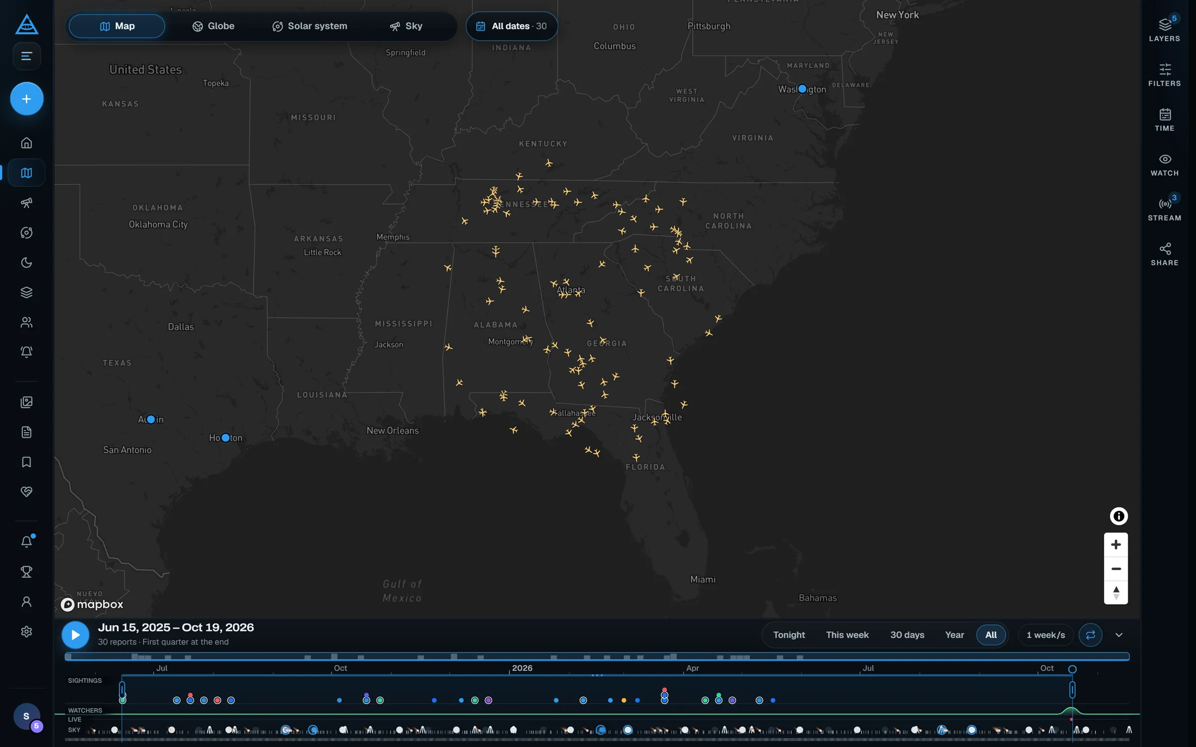
01Live context
See what else was up there, as it happens.
A light in the sky means more when you can see what else is flying. Turn on the live layers and the map fills with real traffic: aircraft from ADS-B receivers, satellites from their orbits, and members who are outside watching tonight.
- Aircraft refresh about every fifteen seconds when you zoom in to a region
- The ISS and bright satellites, positioned live
- Members on watch and sky cameras streaming now
- Forty-nine major observatories around the world
On the map
- SightingsPublic reports, as pins or a heatmapSince 1947
- AircraftLive ADS-B positions via adsb.fi~15 s
- SatellitesStations and bright satellites (CelesTrak)Live
- WatchersMembers outside looking upTonight
- Live viewsSky cameras members are streamingNow
- ObservatoriesMajor optical, radio and solar sites49
02Time machine
Replay the sky, back to 1947.
Drag the timeline to any range, or press play and watch reports appear in order, with fading trails. Lanes underneath show what else happened in the sky: rocket launches, big fireballs, meteor shower peaks, the Moon’s phases and eclipses.
- Tonight, this week, 30 days, a year, or everything
- Playback at the speed you choose, on a loop if you like
- Sky events from launch schedules, NASA fireball data and the meteor calendar

03Find the pattern
Narrow it down to exactly what you saw.
Filter by shape, by status and by evidence, then switch between a flat map, a 3D globe, the solar system and the sky itself. Close together, reports cluster; zoom in and they separate.
- Eight shape categories, from orbs to triangles
- Only confirmed, only with photos or video, only validated
- A heatmap for where reports gather
Views
Shape
Evidence
Under the hood
Real data, credited.
Every layer comes from a named public source, and the map says which.
- Aircraft
- adsb.fi
- Satellites
- CelesTrak
- Sky events
- Launches, fireballs, showers
- Archive
- From June 1947
Community ADS-B network, refreshed about every 15 seconds.
Published orbits, propagated live in your browser.
Launch Library 2, NASA CNEOS and the IMO calendar.
Historical cases alongside every new report.
Questions
About the map
Is the live map free?
Yes, with a free account. Signing up takes a minute, and the map comes with everything else: reporting, Sky Tonight, the Moon and solar system, alerts and the community.
Where does the aircraft data come from?
Live aircraft positions come from ADS-B receivers via adsb.fi and refresh about every fifteen seconds. Zoom in to a region to see them; at world scale there would be too many to draw.
Which satellites are shown?
Space stations, including the ISS, and CelesTrak’s list of bright, naked-eye satellites, positioned live in your browser from their published orbits.
How far back do the reports go?
The timeline runs from June 1947 to tonight. Historical cases from the archive sit alongside new reports, and you can replay any range or just look at tonight.
Can I share exactly what I am looking at?
Yes. Share copies a link to the current view, including the place, zoom, filters and time range, so someone else opens the same map.
Keep exploring
More ways to watch the sky.
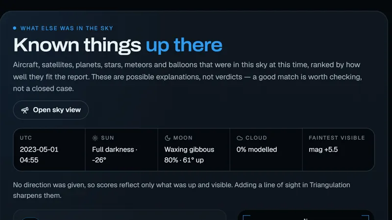 IdentifyIs it Starlink?Every report is checked against the aircraft, satellites and planets in that sky.
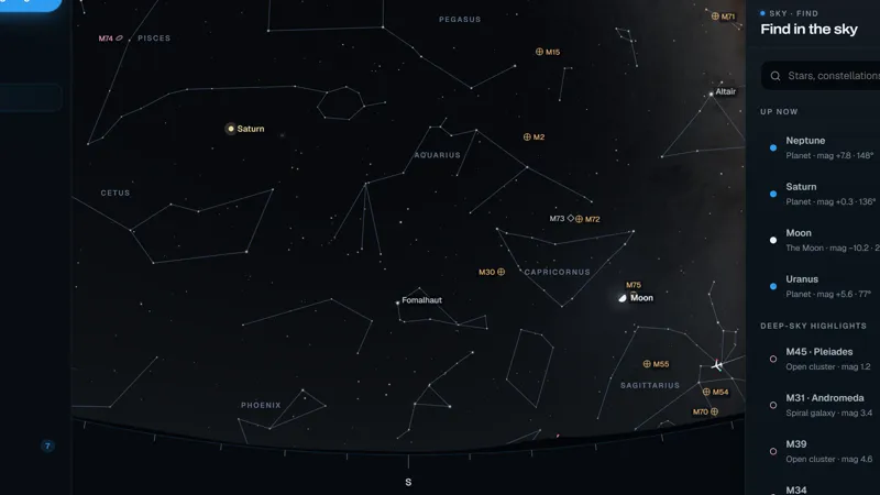 Look upSky TonightThe sky above you right now: stars, planets and what is passing over.
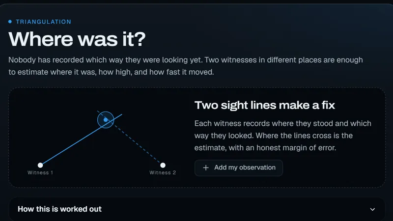 CorroborateWitnessesWhen several people see the same thing, their bearings narrow down where it was.
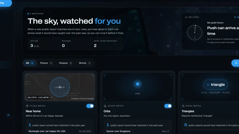 Stay readyAlertsKnow the moment something is reported near you, or the shape you watch for.
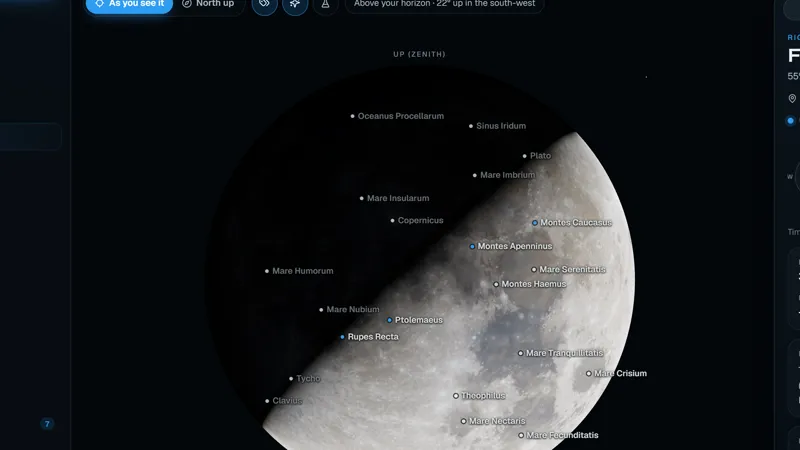 ExploreMoon & PlanetsA 3D Moon and solar system, accurate for any date, so you know what you are looking at.

Tonight
Something is up there. See it on the map.
Free with a Sighted account. Join in a minute and the whole sky opens up.